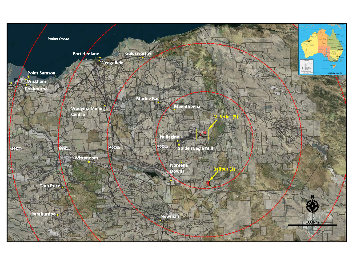
Multiple tenements in an area Southeast of Karratha, Western Australia
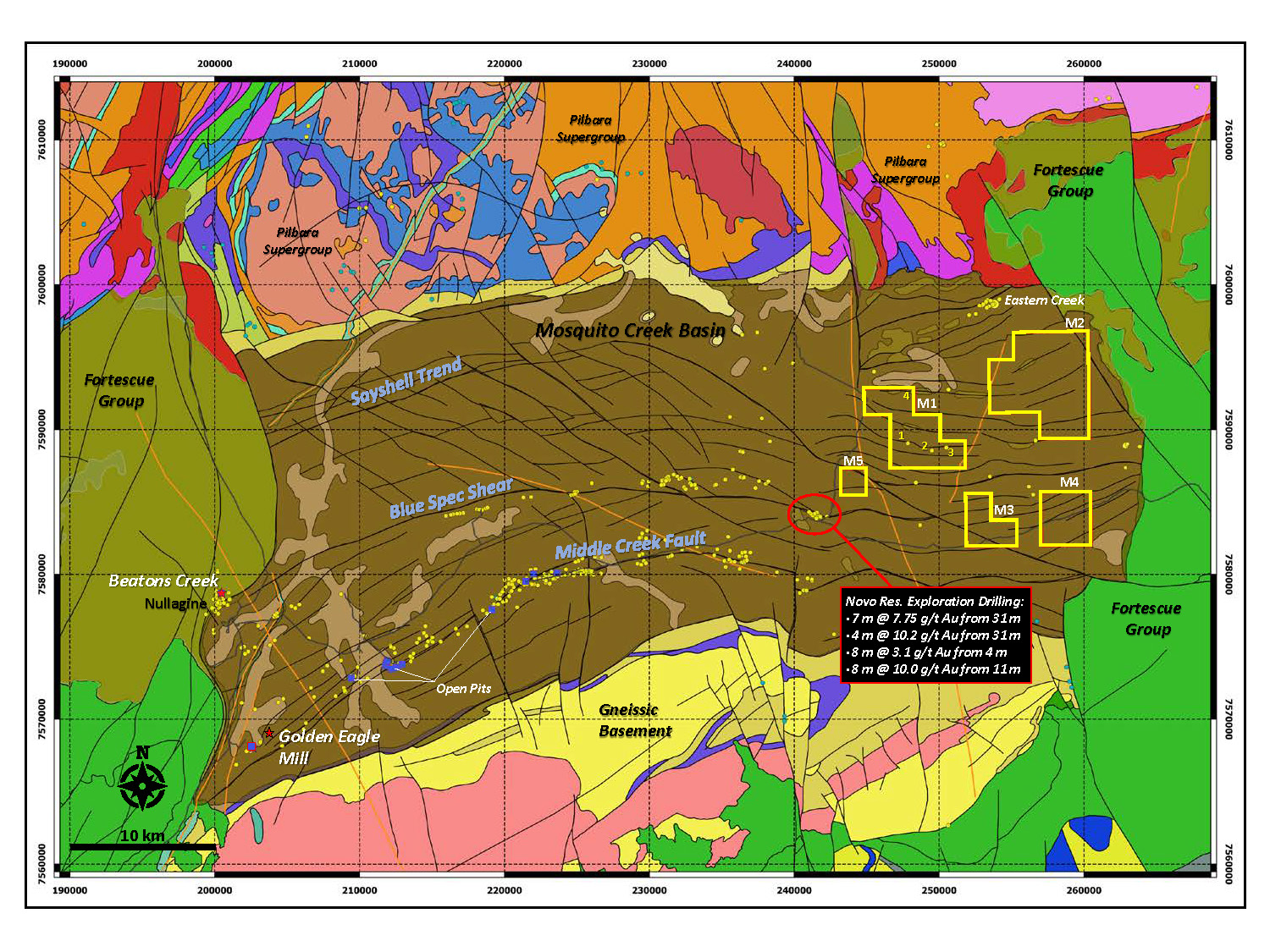
International Prospect Ventures and its wholly owned subsidiary Valroc Ventures Pty Ltd. currently hold 12 tenements totalling approximately 14,890 hectares in the Eastern Pilbara, of which 11 overlying prospective areas of the Mosquito Creek Basin the “Mosquito Creek Properties”.
Several early-stage gold discoveries in the area southeast of Karratha, have been reported by Novo Resources Corp. (NVO) from several properties ("Comet Well" and "Purdy's Reward"; and near Marble Bar and Nullagine at "Beaton's Creek") and separately by two Australian listed companies, De Grey Mining ("Louden's Patch") and Artemis Resources Ltd. (JV with Novo Resources and other 100% owned properties). Collectively, these gold discoveries appear to indicate a potentially gold-rich district, analogous in broad geological terms to the Witwatersrand Basin and its related clastic sedimentary-hosted gold deposits.

The Pilbara Craton
The Early to Late Archaean Pilbara Craton, a 600 kilometre-wide portion of ancient crust, underlies the northwestern region of Western Australia. Comprising igneous and metamorphic basement rocks that formed over 3.1 billion years ago, the Pilbara Craton is thought to have been previously connected with the Kaapvaal Craton that underlies much of South Africa. When connected, these two cratons formed the Vaalbara supercontinent and between 3.1 and 2.7 billion years ago, layers of terrestrial sedimentary and volcanic rocks were deposited across the Vaalbara.
In South Africa, these sedimentary and volcanic rock units make up the Witwatersrand and Pongola basins and in Australia similar sedimentary and volcanic rocks make up the Hamersley Basin. Sometime following deposition (~2.7 billon years ago), the Vaalbara continent broke apart, separating the Kaapvaal Craton (South Africa) from the Pilbara Craton (Australia). While not identical, there are strong geological similarities between the South African Kaapvaal Craton/Witwatersrand Basin and the Australian Pilbara Craton/Hamersley Basin.
The Witwatersrand Basin
The primary gold-bearing clastic sedimentary rocks that make up the gold deposits of the Late Archaean Witwatersrand Basin, referred to as conglomerate, were deposited in ancient rivers, streams and oceans. Subsequent physical and chemical processes over time, introduced gold into the "reefs" that are mined in South Africa. Although there is still no consensus on how and when the Witwatersrand gold deposits formed, most geologists who have studied the Witwatersrand Basin are persuaded by the strong sedimentological controls on gold distribution and so favour palaeoplacer models for gold deposition. More than 1.6 billion ounces of gold have been mined from the conglomerate beds (gold reefs) of the Witwatersrand Basin.
The Hamersley Basin and Fortescue Group
The Late Archaean–Palaeoproterozoic Hamersley Basin and related sub-basins formed on an older granite–greenstone basement (Pilbara Craton) during the initial stages of Late Archaean continental rifting. The Fortescue Group, which ranges in age from 2.8 to 2.6 billion years, unconformably overlies the granite–greenstones of the Pilbara Craton and is commonly compared to the Ventersdorp Supergroup of the Witwatersrand Basin in South Africa. Gold-bearing conglomerates have been identified by Novo Resources Corp. at several stratigraphic levels in the Fortescue Group (e.g., within the Nullagine sub-basin). Similarities between palaeoplacer deposits hosted by conglomerates in the Fortescue Group and the gold-bearing reefs mined in South Africa have been recognized for over a century.
The Nullagine Sub-basin
The Nullagine sub-basin formed on an older granite–greenstone basement during the initial stages of Late Archaean continental rifting and formation of the more extensive Hamersley Basin. Alluvial gold was first discovered in the Nullagine sub-basin in 1886 and by 1893 the Nullagine region had become a major gold field. A hard-rock source for alluvial gold deposits at Nullagine was identified in 1895. In recent years, gold-bearing conglomerates have been identified at several stratigraphic levels in the Fortescue Group within the Nullagine sub-basin, including the recent work by Novo Resources.
In 2016, approximately 45 kilometres south of the town of Karratha, metal detectorists ("fossickers") discovered several areas that were particularly rich in gold nuggets. Metal detectorists have been active along an 8-km long corridor underlain by conglomerate horizons that are part of a 50-100 metre thick sequence of sedimentary rocks at the base of the Fortescue Group. It's interesting to note that this sequence of sedimentary rocks does not appear on most geological maps. Recently, prospectors discovered gold nuggets in-situ, within outcrops of conglomerate, verifying an origin for gold nuggets.

